TurkeyRun Farm Conservation Design
TurkeyRun Farm is comprised of privately owned land adjacent to the White Clay Creek Federal Wild and Scenic River. When the property’s owners were considering future options for the farm, Gaadt Perspectives was retained to undertake an analysis of preservation, planning and development scenarios. The owners’ objectives were to see what level of development the farm could sustain and whether such development could be accomplished in ways that preserved large portions of the land. In addition, the owners wanted to get a better understanding of the land’s valuation, as developed under different scenarios, in order to better understand the property’s value as preserved land (for conservation easement valuation).
This project involved a stepped process using conservation design techniques to balance the “carrying capacity” of the landscape, the human needs/demands on the landscape, and the design constraints and opportunities that provide a dynamic interaction between people and the natural world. The goal of the process is to evaluate different designs that compare and balance human needs (scale, pattern, autonomy, privacy, scenic views, etc.) with the requirements for a sustainable landscape (reduction in land fragmentation, protection of wildlife corridors and species diversity, etc.).
The process involves a thorough understanding of the landowner’s goals for the property; an examination of the natural, scenic and historic resources and land use patterns on and in proximity to the land (collectively referred to as a resource inventory); the preparation of a site analysis (which identifies constraints and opportunities to development – wet, floodprone or steep areas, scenic vistas, meadows, woodlands, stone walls, etc.); the creation of a series of conceptual (preliminary) design sketch plans that identify conservation areas, development areas, and infrastructure areas (roads, etc.); and the formulation of a final design(s) or master sketch plan(s) that can be used for decision making and/or site engineering.
In this particular case, the resource inventory and site analysis yielded two development scenarios: a limited development scenario involving four new 4+ acre house lots on the 90+ acre property, and a conservation design ‘cluster’ development scenario comprised of 27 units on a 20-acre portion of the property (8,000 sq. ft. lots) with a common open space set-aside of up to 70% (significantly higher when considering the entire property). Ultimately, the landowner used the results of the analysis to better inform the decision making process and advance an understanding of the conservation easement valuation for the property.
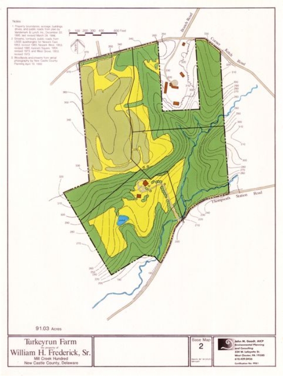
Base plan
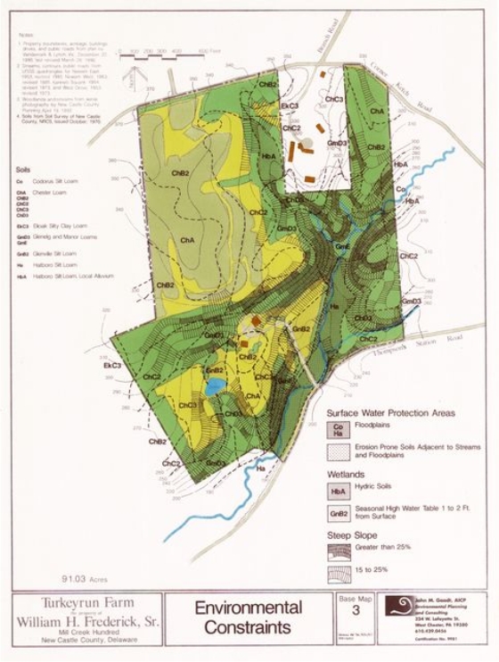
Environmental Constraints
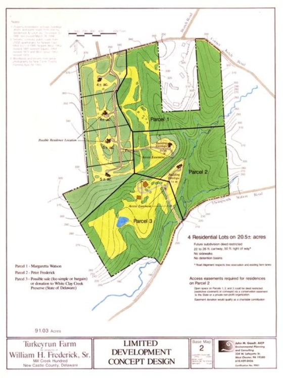
Limited Development Plan
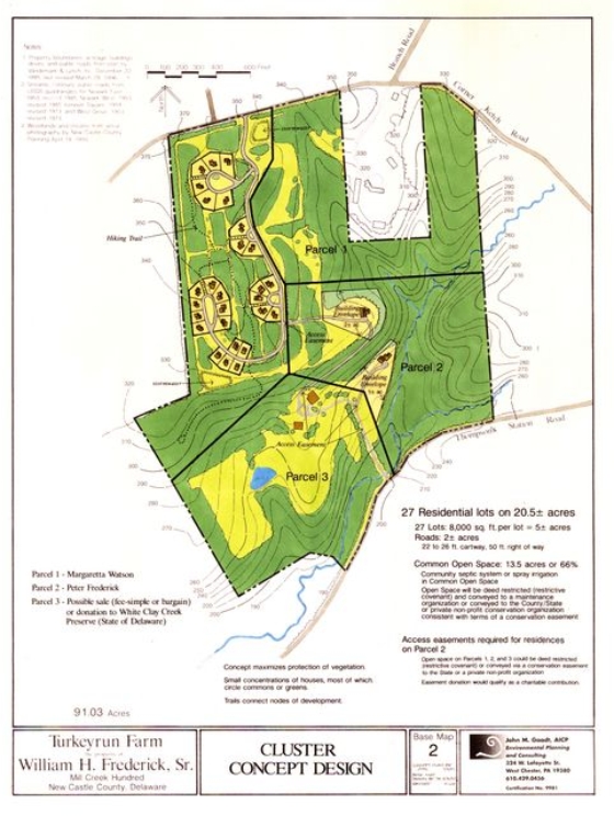
Conservation Site Design